


I used to live in Seattle, and I have a lot of friends around there, so all the recent flooding really hits home. Like most people, the first thing I wanted to know was whether my friends were safe and their homes were still intact. I found some great user-created maps that offer more context around what is actually happening on the ground than a few isolated photos or videos from news stories can provide:
December 2007 Flooding shows flooding in Snohomish and Island counties.

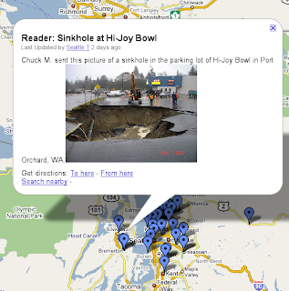
Storm reader reports was produced by the Seattle Times from reader reports.
Kitsap/Mason Road Closures shows roads that have been washed out.


0 comments:
Post a Comment